North American Canal Transits
By Theodore W. Scull.
Updated Oct 2024
Digging canals dates back to the Ancient World from simple shallow channels for irrigating fields to more substantial waterways to move building stones, crops and people. Wheeled transport, where it existed, was hindered by poor road surfaces and the loads carried could not approach what a canal barge transported.
In Part One of our canals series, we looked at Europe’s contribution to providing useful waterways for QuirkyCruise-type small ships traversing the Suez, Corinth, Main-Danube, North Sea, Kiel and Caledonian canals.
Now in Part Two, we look at the North American waterways plied by small-ship cruises.
Erie Canal
Historically, in the U.S., the Erie Canal became the most important waterway when completed in 1825 between Lake Erie and the upper Hudson River a few miles above Albany, the state capital.
Its construction gave New York City direct water access to the West via the Great Lakes, and in short order, the city’s port surpassed Boston and Philadelphia, both having to contend with mountain ridges to the west impeding freight and passenger carriage.
The Erie Canal was later superseded by a mostly new parallel canal, and for a time it was referred to as the New York State Barge Canal. When the freight pretty much died away due to competition from railways and highways, it reverted to its original name — Erie Canal — and became a recreational waterway. Remnants of the original waterway remain for the historically-minded to seek out.
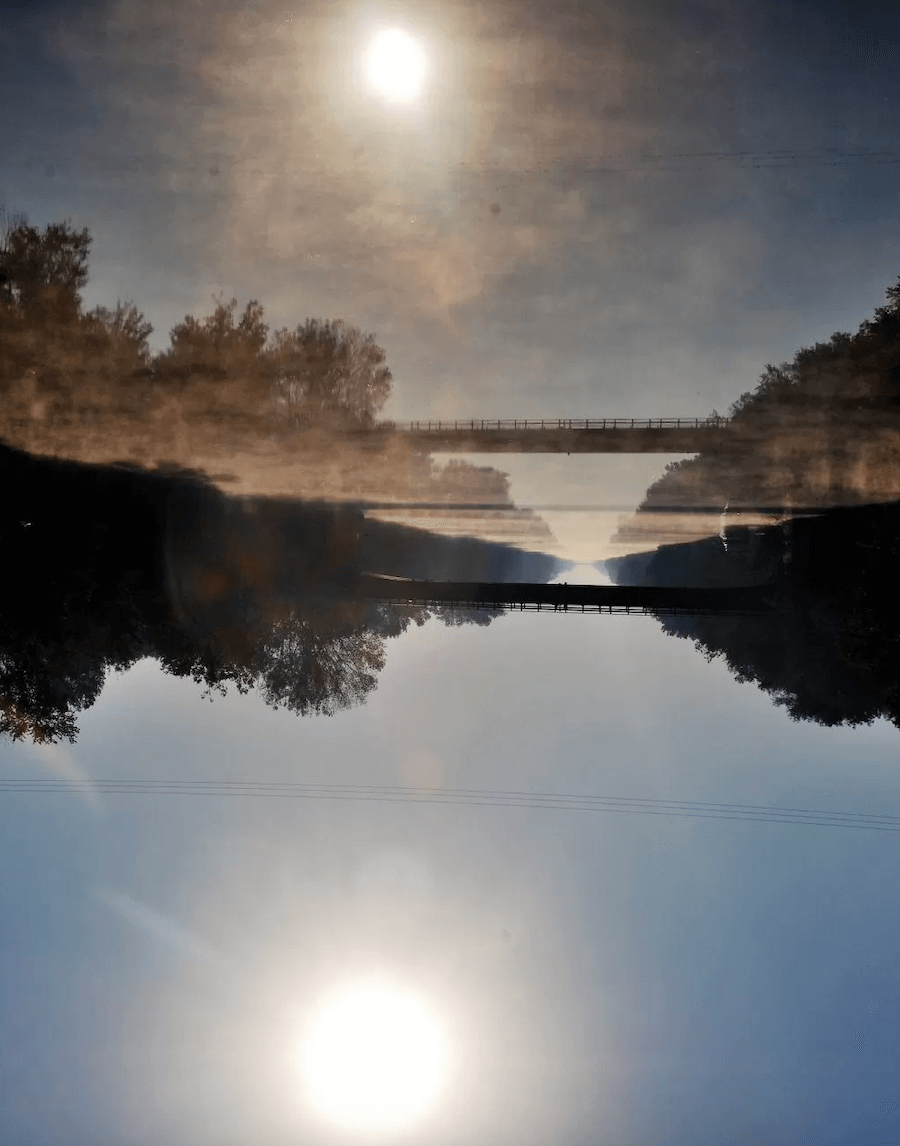
Sun climbing over the Erie Canal. * Photo: Ted Scull
Once Blount Small Ship Adventures (sadly, the line is now defunct) had small enough ships to travel its entire 363-mile length between Albany and Buffalo.
Until its demise in 2020, the line’s vessels cruised between New York and Montreal and New York and Chicago, turning northwest beyond Syracuse and using the 24-mile Oswego Canal (1828) to reach Lake Ontario where they continued their onward journey to either city.
Both canals use locks and dams to maintain sufficient depth and to keep the water flow to a minimum for navigation in areas when the terrain becomes hilly.
The canal transits pass through mostly scenic countryside, and the pilot house has to be dismantled to be able to pass under the low bridges the railroads built to impede canal traffic. The complete route, involving the Hudson River, two canals, Lake Ontario and the St. Lawrence Seaway, is endlessly fascinating.
Cape Cod Canal
On the U.S. East Coast, salt and brackish water canals for oceangoing ships came about in the 19th and early 20th centuries. The most northerly is the Cape Cod Canal that slices seven miles through an eastern portion of Massachusetts about half way between Boston and Hyannis severing Cape Cod from the mainland. The idea for a canal originated with the Plymouth Colony and then was revived during the American Revolution but it did not open until 1914.
The water level waterway shaved off 135 miles for ships sailing between New York and Boston. While the construction was privately financed, the tolls were set too high, so in 1928 the government assumed control.
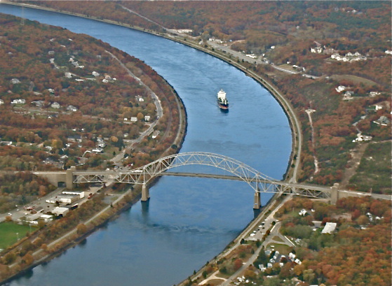
Aerial view of the Cape Cod Canal.
But soon, the competing New York, New Haven and Hartford Railroad rendered it redundant for coastal passenger vessels, while later, road and rail traffic caused a steep decline in coastal freight shipping. While the Cape Cod Canal could handle good-size freighters of up to 825 feet, today’s container ships are much too large to transit it.
It is used mainly by yachts and barges and occasionally by American Cruise Lines for the New England itineraries.
The 7-mile canal is a gently curving link between Buzzards Bay and Cape Cod Bay. Notable points of interest are the Massachusetts Maritime Academy; the elaborate 1935-built railroad lift bridge with twin 271-foot steel towers; and the Bourne and Sagamore bridges, the former most notable for its traffic backups in the summertime primarily because of the traffic circle on the Cape Cod side.
The small-ship lines that ply the Cape Cod Canal
- American Cruise Lines
- Victory Cruise Lines
Chesapeake & Delaware Canal
Further south, the Chesapeake & Delaware Canal (C&D Canal) is simply named as it connects the Delaware River to the Chesapeake Bay. Ships sailing between Philadelphia and Baltimore use the canal to avoid having to travel south along the Delmarva Peninsula, then turn into the Chesapeake Bay and double back north to reach Baltimore.
American Cruise Lines (and Blount when it was operating) uses the canal on transits between the Northeast, the Chesapeake Bay and Intracoastal Waterway, to avoid the potentially rough open sea along the Delmarva Peninsula.
The 14-mile-long C&D Canal is 450 feet wide and has a depth of 32 feet as it cuts across Delaware and Maryland. It is owned and operated by the U.S. Army Corps of Engineers, Philadelphia District.
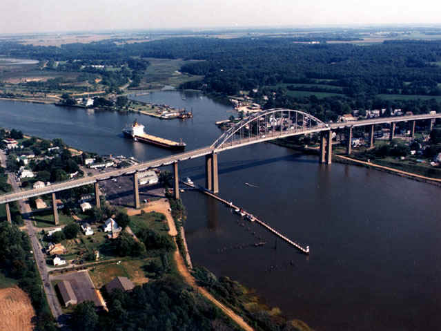
Chesapeake & Delaware Canal at Chesapeake City.
Construction started in 1804, then halted for lack of funds and restarted and finished in 1829, with locks and 10-foot depth.
It was used for barge traffic only until 1919 when the Army Corps began expanding and deepening it, eliminated the locks and raised the bridges to allow deep-sea ships to transit it by 1927.
Today there is a healthy amount of commercial traffic (one way only with large ships) bound for and sailing from the Port of Baltimore. The C&D is listed on the National Register of Historic Places.
Its canal banks are popular for sightseers and summertime barbecues, so expect to exchange greetings. If you are driving in the area, there is a fine canal museum at Chesapeake City, a former coaling port.
The small-ship lines that ply the Chesapeake & Delaware Canal
Albemarle & Chesapeake Canal
The Atlantic Intracoastal Waterway extends some 1,300 miles along the East Coast and at the south end of Chesapeake Bay. Yachts and small coastal cruise vessels use the Albemarle and Chesapeake Canal to stay in calm waters.
Opened in 1859, the 70-mile sea level water route connects two rivers, the Elizabeth River in Virginia, near Norfolk and the North Landing River in North Carolina. Only 14 miles in between had to be excavated to create the canal.
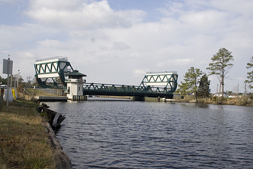
Albemarle & Chesapeake Canal
In 1912, the U.S. Government took it over while the Army Corps maintains it to a depth of 12 feet. The route though flat is quite scenic and wooded, passing through swampland and terra firma.
The area also includes the more or less parallel Dismal Swamp Canal, and both waterways are noted for many species of birds.
Small boat traffic is considerable during the spring and fall boating migration months. South of the A and C, no more canals of any consequence exist until Florida. The Cross Florida Canal begins at Stuart on the East Coast and ends near Ft. Myers on the Gulf of Mexico. It is occasionally used by the coastal cruise companies.
The small-ship lines that ply the Albemarle & Chesapeake Canal
St. Lawrence Seaway
Some canal-style waterways have different designations, and one such is the St. Lawrence Seaway, a combination of dredged channels or canals, a series of locks and the namesake river itself. The seaway is owned jointly by Canada and the U.S. The end points are designated Montreal in the east and Port Colborne, Ontario in the west, adding up to a total of 370 miles. Hence Lake Ontario and the scenic step-up Welland, with its eight locks, are included.
Construction started on the seaway in 1954 under President Eisenhower and was completed in 1959.
From the Atlantic Ocean at the mouth of the St. Lawrence River to the far western end of Lake Superior is 2,340 miles. The deep-water route brought high hopes as a major trade corridor, and at first projections were met. However, changing trade patterns, the use of faster railroads to move higher value cargo in containers from the interior of the U.S. and Canada to coastal seaports for onward shipping cut into its use.
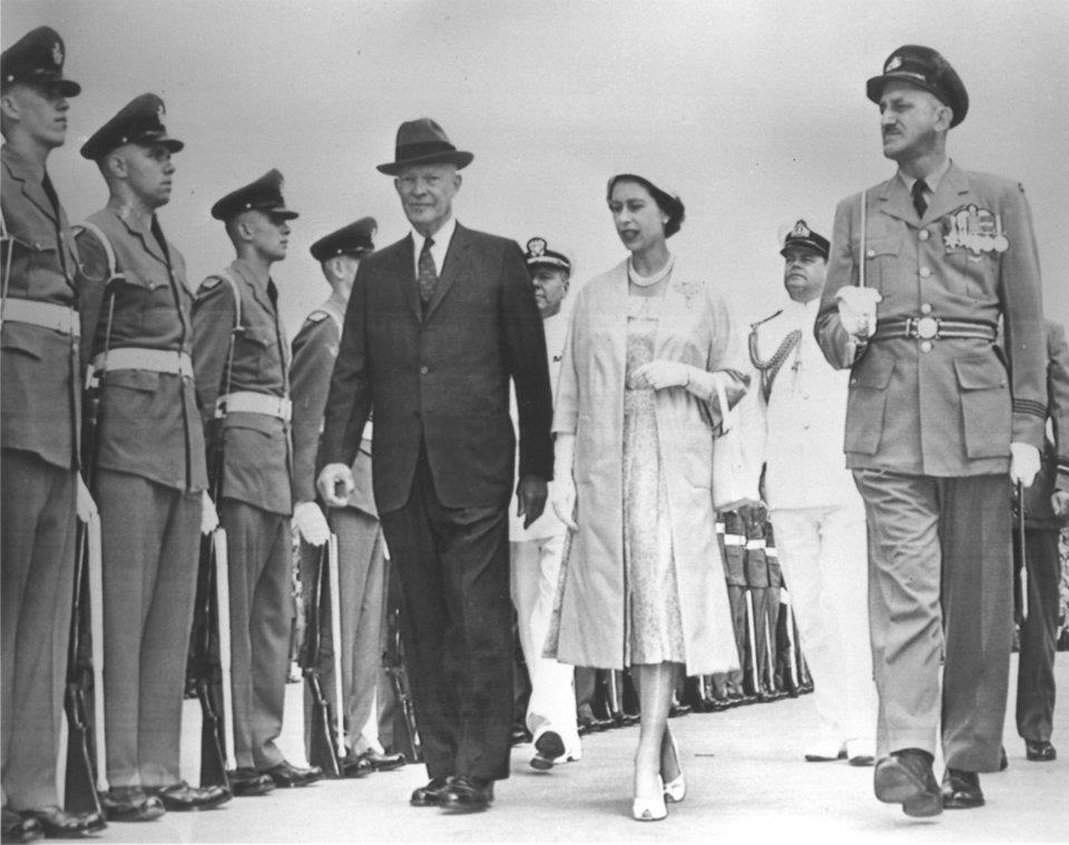
President Eisenhower at the opening ceremony of the St. Lawrence Seaway.
Today major commodities carried are bulk items such as iron ore, coal, limestone, grain, cement, salt and stone aggregate. Many of the bulk carriers are referred to as lakers, and their unusual design sees the superstructure housing some of crew located all the way aft and the cargo holds stretching nearly the ships’ entire length to the bow navigating superstructure housing the officers.
Some small ship cruises stay pretty much in the channels between Lake Ontario via the Seaway to Montreal and on down river to Quebec and the Saguenay River. Several lines continue on west into Lake Erie via the Welland Canal, Detroit River into Lake Huron, and through the Straits of Mackinac to Lake Michigan and south to Milwaukee and Chicago. Small vessels can use a series of connecting rivers and canals going west to reach the Mississippi River. Blount used to make this trip ending in New Orleans.
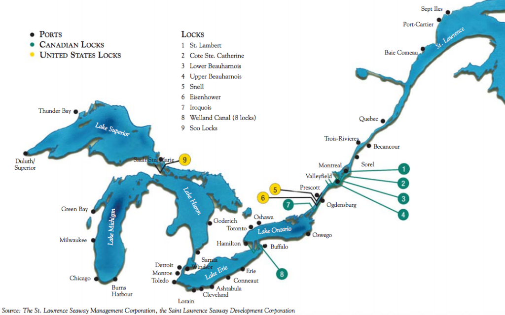
St. Lawrence Seaway and Great Lakes. * Photo: St. L. Seaway Dev. Corp.
The small-ship lines that ply the St. Lawrence Seaway
- American Cruise Lines
- American Queen Voyages (defunct)
- Blount Small Ship Adventures (defunct)
- Croisieres Jacques-Cartier (defunct)
- Ontario Waterway Cruises Inc
- St. Lawrence Cruises Lines
- Victory Cruise Lines
Ontario Waterways
The lower part of the Canadian Province of Ontario harbors a series of lakes that have been connected to form continuous waterways, while the Rideau Canal connects this region with Canada’s capital to the north at Ottawa.
A Peterborough to Ottawa trip takes to the Rideau River and the 1832-built Rideau Canal (35 locks), forming one of the great engineering feats of the 19th century. The waterway ends below the handsome architectural setting of Parliament Hill as it steps down and empties into the Ottawa River.
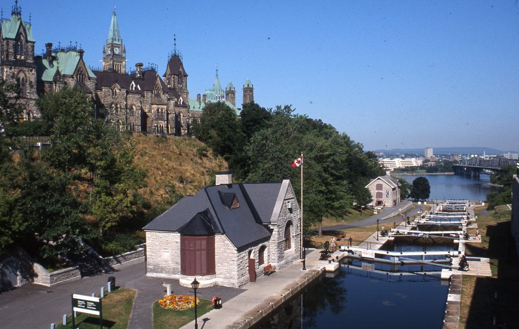
Rideau Canal steps down to Ottawa River below Parliament Hill. * Photo: Ontario Waterway Cruises
A second waterway itinerary begins at Peterborough and takes to the Trent-Severn Waterway, passing through 22 locks (including the great Lift Lock with a 65-foot rise) along the connecting Kawartha Lakes and the Severn River to Big Chute. Here a fascinating marine railway carries small yachts in a cradle down to Lake Huron.
The small-ship lines that ply the Ontario Waterways
RELATED: Cruising with the family along the Rideau Canal on a self-drive Le Boat vessel, by Judi Cohen.
RELATED: Judi Cohen review her Rideau Canal cruise on the classic Kawartha Voyageur houseboat.
RELATED: QuirkyCruise's Ted Scull looks back on his Kawartha Voyageur cruise in 1997.
Lynn Canal
As it is likely to come up if you are taking a small ship Alaska cruise, the so-named Lynn Canal is really an inlet (or fjord) stretching 90 miles. It boasts an impressive depth of 2,000 feet, providing a navigable waterway to reach Haines and Skagway. Along the way, you might spot humpback whales, orcas, porpoise, and Steller sea lions.
The small-ship lines that ply the Lynn Canal
- Alaska Marine Highway
- Alaskan Dream Cruises
- American Cruise Lines
- Lindblad Expeditions
- UnCruise Adventures
RELATED: Ted Scull looks about on a memorable Alaska Marine Highway trip in 1980.
RELATED: John Roberts reviews his UnCruise Alaska adventure.
RELATED: The Seldons review an adventurous small-ship cruise with Alaskan Dream Cruises.
| Canal | Location | First Completed |
Length (miles) |
Locks or Sea Level |
| Erie Canal | New York State | 1825 | 363 | Locks |
| Cape Cod Canal | Massachusetts | 1914 | 7 | Sea Level |
| Chesapeake & Delaware Canal | Delaware & Maryland | 1829
Rebuilt 1927 |
14 | Locks 1829
Sea Level 1927 |
| Albemarle & Chesapeake Canal | Maryland & Virginia | 1859 | 70 | Sea Level |
| St. Lawrence Seaway | Canada & USA | 1959 | 370 | Locks |
| Ontario Waterways | Ontario, Canada | Rideau Canal 1832
Trent Severn Waterway 1920 |
125
239 |
Locks
Locks |
| Lynn Canal | Alaska | Natural Waterway | 90 | Sea Level |
Hope you enjoyed Ted's Look at North American Canal Transits!
Don’t miss a post about small-ship cruising, subscribe to QuirkyCruise.com for monthly updates & special offers!
© This article is protected by copyright, no part may be reproduced by any process without written permission from the author. All Rights Reserved. QuirkyCruise.com.





 HEIDI SARNA

